The following terms have been selected and defined in order to clarify and contextualize some of the scientific language used in our reporting. This list is neither comprehensive nor exclusive.
- Acidification
- Albedo
- Anthropogenic
- Brown & Grizzly Bears
- Cryosphere
- Delta
- Dusky Goose
- Elder/Traditional Knowledge
- Gillnetting
- Glacier
- Lincoln-Peterson Index
- Meander/Braid
- Otolith
- Permafrost
- Salmonidae
- Sea Otters
- Seining
- Subsistence Lifestyle
- Uplift

The scientific phenomenon in which carbon dioxide absorbed by the ocean changes the water’s ph balance, making it more acidic. Often referred to as “the sister problem to climate change.” Organisms that build calcium carbonate shells for themselves are the first to be negatively effected by OA as they are unable to pull the carbonate they need from the water to build those shells.
This has the potential to be a problem for the fish and crab industry in Alaska. One of the earliest organisms to show negatives side effects of acidification is the pteropod, a small snail that “flies” through the water and is a key staple in many ocean dweller diets. Colder waters can hold a larger amount of carbon dioxide, meaning they can be more acidic than their southern neighbors. Combine this with Alaska’s freshwater glacier run-off—water that contains none of the nutrients found in oceanic water— mixing into the oceanic waters and the problem becomes exacerbated.

The amount of light or radiation reflected by a surface of the Earth. Using a spectroradiometer, albedo is calculated by dividing reflected light by incident light. A change in albedo is crucial to the many glacier examples used to prove the existence of climate change because it drastically affects the water temperature, sea level, glacial melt and even the ocean circulation patterns.
Between 70 and 80 percent of the sun’s rays that hit snow or ice surface are mirrored back out into the atmosphere, meaning it has a high albedo.
The trouble begins when heat rises. With warmer temperatures, some of the snow and ice melts, exposing the darker land or water underneath that are poor reflectors. Then a feedback loop kicks in. Increase in heat is absorbed by the darker surface, so more snow and ice melt. More of the darker surface is exposed, leading to the absorption of extra heat, escalating snow and ice melt, and the cycle begins once again. Just a small temperature increase can set this cycle into motion.
Since a large part of Alaska is made of snow and ice, the ecosystems there can easily be affected by climate change. Columbia Glacier in Prince William Sound is a prime example, having receded half of its total thickness since the 1980s.
It is said that as the albedo decreases, we will see larger decline in the thickness of glaciers and some will even disappear without a trace.

The resulting effect of human activity on any object. Here, it is used as a categorical descriptor of climate change.
Anthropogenic climate change refers to the extent to which human activity has played a role in altering the global atmosphere. Our post-industrial use of natural resources has produced amounts of greenhouse gases that scientists confirm can not be produced under natural occurring circumstances, irrevocably changing the Earth’s biodiversity and weather patterns. According to scientific claims, the planet will not be able to support human resource consumption in the long term.

Brown bears — Ursus Arctos — are the most widely distributed bear species in the world.
Brown and grizzly bears are technically classified as the same species even though there are noticeable differences between them. The common name for the species is “brown bear,” but only coastal bears in Alaska and Canada are referred to as such, while inland bears and those found in the lower 48 states are called grizzly bears. All grizzlies are brown bears, but not all brown bears are grizzlies.
Bears live in and use a variety of habitat types, playing important roles in each one. This makes them an “umbrella species,” meaning that when we protect them and their habitat we also protect many species.
Like humans, brown bears are very adaptable and consume a wide variety of foods. Common foods include salmon, berries, grasses and roots. In many parts of Alaska, brown bears are predators of moose and caribou. They are generally solitary but will appear in large groups in feeding areas such as salmon spawning streams.
Brown bears typically live along the coast where they have access to spawning salmon. The coast regions also provide rich vegetation they can use as food as well as a milder climate. These conditions allow brown bears to grow larger than grizzly bears.
Grizzly bears are omnivores, and their diet can vary widely. They may eat seeds, berries, roots, grasses, fungi, deer, elk, fish, dead animals and insects. They are found many different habitats, from dense forests to subalpine meadows, open plains and arctic tundra. They are normally solitary animals, however, they are not very territorial and may be seen eating together where food is abundant.

The frozen portion of the Earth’s surface that is the second largest component to climate change. It includes snow, river and lake ice, sea ice, glaciers and ice caps, ice shelves, ice sheets and frozen ground. It is a significant aspect of climate change study due to how crucial and visible its transformations are.
The cryosphere is important to keeping Earth cool by reflecting 60 percent to 90 percent of solar energy back into space. As more energy is absorbed because of increased warming, the cryosphere begins to shrink, which can cause a change in air temperature, sea level, ocean currents, and even storm patterns.
Studying the cryosphere by examining ice cores provides valuable information on past, present and future climate change. Ice cores can also reveal how human activity affects climate change and what the temperatures have been between past ice ages.
Alaska’s melting cryosphere is known for being one of the largest contributors to rising sea levels. As this continues, it is said that many places around the world will eventually be submerged.

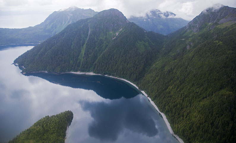
When rivers empty water and sediment into another body of water (ocean, lake, etc.), a delta is formed. This silt creates something entirely new, which may explain why deltas are crucial for ecological stability. Life of all kinds finds support in a delta.
For example, the Copper River Delta (CRD) spans 700,000 acres and is located right along the Pacific Flyway. It serves as a staging area for over 16 million shorebirds and waterfowl, as well as a home to many more birds, marine life, and mammals. In this ecosystem, salmon spawn and migrate, providing a meal for wolves and bears, and for the survivors, their decomposing bodies bring new life to the area with nutrients. When looking at the salmon alone, the CRD supports five native Pacific salmon species that if the populations dwindle, a host of ecological, economical, and cultural issues will occur (both in the region and globally).

A subspecies of the Canada Goose, the Dusky Goose finds breeding grounds on the Copper River Delta and the islands of the Prince William Sound.
Dusky geese migrate south along the Pacific Ocean in the fall, ending in the Willamette Valley and Columbia River in Oregon and Washington to spend the winter. There, they feed on nutrient-rich grass and begin the migration north again in early April. The Copper River Delta is the only place they nest. Changes in temperature may affect migration patterns in the long run, as springs become earlier and winters become wetter with larger storms.
The March 1964 earthquake on the Copper River Delta created uplifted marshes, morphing wetlands into more forested, shrubby areas, increasing cohabitants with predators such as foxes and bears. This leads to fluctuations in the Dusky population, which has recently dipped below the 10,000 threshold population count.

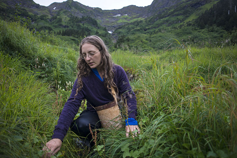
The term “elder” carries varying definitions in Alaska Native communities. In some cases, like the one presented by the National Resource Center for American Indian, Alaska Native and Native Hawaiian Elders, an Elder is a member of the community who is 55 or older. But as the Center later explains in their report on the Health Status of Alaska Native Elders, “someone who is considered an Elder in a community may not be elderly. Similarly, someone who is elderly might not necessarily carry the mantle of an Elder.”
In many cases, the Elders of an Alaska Native community pass down traditional cultural knowledge to incoming generations.
Traditional knowledge is information or histories passed down from one generation of a community to another. Frequently, it is continued in an oral tradition in the form of stories, folklore, art and dance. It is practical information regarding the environment around a community and the best way to use the available resources.
According to Nativescience.org, “It cannot be compartmentalized and cannot be separated from the people who hold it. It is rooted in the spiritual health, culture and language of the people.”

A technique implemented by native fishers of the Prince William Sound used to catch salmon. A fine-filament net is floated along the surface of the water between a fishing boat and a buoy; it drapes underwater using a heavy lead line and intersects the pathway of migrating salmon. The holes in the net are variable depending on the season and species. The idea is to allow the fish to enter but once they attempt to back out, their flared gills are caught against the lines, effectively trapping them.
A particular method of gillnetting that has received backlash is high-sea drift fishing. This large-scale commercial practice relies on catch-all nets to collect massive hauls of fish. Oversized nets not only yield to the overfishing of Alaskan salmon, but to the slaughter of additional sea life and are listed as a factor in the waning numbers of species.
In Cordova, at the head of the Orca inlet in the cold blue waters of the Prince William Sound, gillnet fishing is a part of the lifeblood of the people and a carefully monitored system. Beginning in late spring and lasting through summer, the boats cast their nets in search of schools of Sockeye (Red) and Coho (Silver). They work near the shore, waiting patiently until a full catch is ready to be hauled aboard. The boats operate during 12-24 hour “openings” and are limited to 900-foot long nets. “Set” gillnetting recognizes the health of the system and the sustainability of the species. The harvest is not reliant on a greedy disruption of the natural cycle but rather focuses on balance within the capacity of the ocean fisheries and a mutual rhythm of life.

Glaciers are compacted snow. If the rate of snow accumulates faster than the rate of snow ablation (the loss of snow through evaporation or other erosive processes) the weight of the snow turns the mass into ice. At that point the snowfield becomes a glacier. A sheet of ice on water, either fresh or salt, is not a glacier.
What makes glaciers unusual is they move, like a slow motion river. The speed of a glacier’s movement varies widely, but it is generally about three feet per day. Some, however, reach a speed of up to almost 100 feet a day.
Almost all of the Earth’s glaciers, ninety-nine percent, are found in the polar regions. A glacier larger than 50,000 square kilometers is an ice sheet, and currently only two exist: the one that covers most of Antarctica and the one on Greenland. Just those two glaciers alone contain so much water that if they both melted the ocean level would rise by over 200 feet.
When a glacier reaches the sea, large portions of the front wall break off—a process known as calving. Where a glacier originates is called the head and where it ends is called its foot or terminus.
With the exception of a brief period of advances of glaciers between 1950 and 1985, the Earth’s glaciers have been in retreat since the end of the Little Ice Age in about 1850. When a glacier retreats it leaves behind debris of rock and soil accumulated during its movements down the mountainside. This debris is called the moraine.
In Alaska, more than 600 glaciers have been named, but it is believed there are more than 100,000 in the state.
John Muir visited Alaska in 1879 and with Samuel Hall Young were the first to explore what is now known as Glacier Bay and Muir Glacier.
Within easy driving distance of Cordova, one can see 14-mile-long Sheridan Glacier (only 15 miles from downtown); Sherman Glacier, 8 miles long; Scott Glacier, 14 miles long; Childs Glacier, 11 miles long; and Miles Glacier, 30 miles long.
Glaciers are important to climate change studies because even a slight change in global temperature causes dramatic changes in glacial activity.

The Lincoln-Peterson index is an animal population estimator used by researchers on the Copper River for estimating the salmon population.
The Lincoln-Peterson index is a method of estimating an animal population by marking and recapturing animals within a closed system. Researchers on the Copper River have two camps established for using this method to create an analysis of the salmon run population in the area. Monitoring the population allows for preservation and ensures longevity of this natural resource.
The researchers at the lower camp capture salmon using a fish wheel and then mark them. The marking devices they use on the salmon are comparable to the ones used to identify dogs or cats. The salmon are recaptured further up the Copper River at the upriver camp. The researchers then use the proportion of fish recaptured with tags to those without tags to generate an estimate of the salmon run for the season. They can compare this information to population estimates of past years to ensure proper use and future sustainability of the resource.
This process is monitored and maintained by the Village of the Eyak, who treat it as a fundamental responsibility.

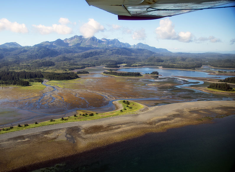
Meanders are bends in a stream channel that take on a number of measurable characteristics that tell much about landscape, geology and even local weather events and climate. The curvature of meanders depends on the flow of the stream and the material that it’s running over and through: Malleable but firm banks and deep channels shape streams that bend back on themselves while loose round stones and shallower water dispersed widely tends to run straighter, making shallow bending braids instead of meanders. Where a braid stops and a meander begins belongs to the math performed by hydrologists and geomorphologists, which contains its own beauty.
Generally, faster, deeper water runs on the outside of the bend with the tendency for the outside of the curve to continue to move outward. If conditions are right, a meander might loop so tightly on itself that flooding water cuts off the loop, leaving the bend and the water in it isolated from the main flow. The glacier-fed streams around the Copper River Delta show braiding and meandering characteristics, and from the sky, many channels appear. One researcher likened the annual floods on the Delta to a what happens with an unattended fire hose – from year to year the stream beds move radically, forming and reshaping islands and meanders. The result is lots of rich potential habitat for young salmon, especially when the glacier-fed water subsides and clearer groundwater takes over the channel flow.
Etymologically speaking, a meander is shaped by litheness and suppleness and conflicting sense that you always know where a stream ends, but how it chooses to get there is another matter. You can’t really get lost on a river, but there should be a word for the feeling that you’re not sure how many bends of the river are left before you arrive at your destination.

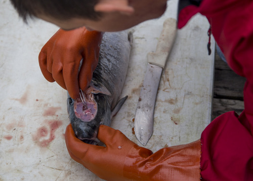
An otolith is any number of calcareous particles, or minute calcium carbonate granules, found in the inner ear of certain lower vertebrates, like salmon.
Otoliths are formed by the incremental and constant accumulation of protein and calcium carbonate, and this process is very sensitive to environmental and physiological change. It leaves growth “rings” which allow scientists to better determine fish age and to study the history of each fish.
Age determination is vital for understanding the productivity of fish populations, which in turn is essential to the many groups who depend on fish for their livelihood, like hatcheries and fisherman. So this tiny bit of bone means a lot to the fishing industry.
Some time ago, hatcheries in Alaska, and other parts of the world, discovered how to mark their fish by rapidly altering water temperatures while salmon eggs and fry are incubating, to create a pattern of growth rings unique to each hatchery.
As of the year 2000, more than five billion Pacific salmon have been thermal marked by hatcheries in four countries around the North Pacific Ocean, according to the Alaska Department of Fish and Game.
The Prince William Sound Science Center (PWSSC) is in the middle of a four-year project on contract with Alaska fish and game, studying the interactions of hatchery and wild pink and chum salmon in the Prince William Sound and Southeast Alaska. One of their main methods of determining whether a salmon is wild or hatchery-bred is the otolith.
They are also trying to understand the impact of the interactions between native fish and hatchery fish, in the hopes of maintaining the unique identity and health of each species. This could greatly impact the entire fishing industry, because Copper River salmon are famous nationwide. And if there are more hatcheries than wild salmon, what does that mean for the fishing-based economy of many coastal Alaskan towns?
So, various groups from the PWSSC are surveying both streams and oceans, hoping to find dead chum and pink salmon that they can collect otoliths from.

Derived from the words permanent and frost, permafrost is a classification of soil or ground. It can be classified as continuous, discontinuous and sporadic depending on how much of the land it covers. In general, permafrost gets colder and thicker — up to 1500 meters — farther north and in some cases can melt and refreeze.
Thawing of permafrost can sometimes be a natural process, like in the cases of deep permafrost where upper layers may thaw in summer but refreeze in winter. Permafrost thawing has become more and more common since the 1970s as the climate changes. As thawing happens, issues with drainage, sinking roads, and trees rooted in frozen soil occur.
Permafrost also holds massive amounts of carbon and methane, which when released cause climate change. The estimated amount of carbon stored in permafrost equals nearly double the amount currently stored in our atmosphere.

In the system of biological classification, salmonidae (singular salmonid), in the order salmoniformes, are a family of “soft-finned fishes including as generally understood the salmons, trouts, chars and whitefishes all of which are elongate and shapely and have the last vertebrae upturned.” Members of salmonidae have an adipose fin, which is a small fin located on the top of the fish near the base of the tail. Other shared characteristics include a single row of sharp teeth and a forked tail.
In Alaska, members of the salmonidae family include the genera Oncorhynchus, Salvelinus, and Coregonus, although many more genera are included in the salmonidae family. Oncorhynchus are Pacific salmon and trout, Salvelinus are char and trout, and Coregonus are whitefishes. These genera have various species that can be found throughout Alaska and the Pacific ocean.
According to the Alaska Department of Fish and Game, the species are as follows:
- Chinook Salmon (Oncorhynchus tshawytscha)
- Chum Salmon (Oncorhynchus keta)
- Coho Salmon (Oncorhynchus kisutch)
- Pink Salmon (Oncorhynchus gorbuscha)
- Sockeye Salmon (Oncorhynchus nerka)
- Cutthroat Trout (Oncorhynchus clarkii)
- Steelhead/Rainbow Trout (Oncorhynchus mykiss)
- Lake Trout (Salvelinus namaycush)
- Dolly Varden (Salvelinus malma)
- Arctic Char (Salvelinus alpinus)
- Arctic Cisco (Coregonus autumnalis)
- Bering Cisco (Coregonus laurettae)
- Broad Whitefish (Coregonus nasus)
A defining characteristic of the family is that “many are anadromous, spending part of their life at sea, but returning to freshwater where all species spawn in a gravel bed in rivers or streams; most fish die after spawning,” according to FishBase.org.

Sea Otters are entirely aquatic mammals that live on the North Pacific Coastline. They are known for their thick fur, which was in such demand in the late 1700s and 1800s that populations of sea otters dropped to near extinction. The Marine Mammal Protection Act now protects otters from being hunted, and has helped populations grow significantly.
Otters play a special role in the ecosystems of Pacific coastlines by keeping urchin populations in check. Sea urchins feed on kelp and when populations are high because of unhealthy otter populations, kelp suffers. Kelp forests support a variety of life from fish to sea horses and store large amounts of carbon.
It has been said that kelp forests can store as much carbon as tropical rain forests, helping to prevent carbon from entering the atmosphere.
Ninety percent of the world’s populations of sea otters live in Alaska, making Alaska’s kelp forests some of the healthiest in the world.

Seining is a method of fishing that uses a dragnet (seine). There are two types of seining methods: Danish seining, and the most common of the two, purse seining.
The captain of the fishing boat (seiners) will first choose an area to harvest the fish and then draw out a large net in a circle. The net has buoy rings holding up the top edges as the netted bottom hangs beneath the water’s surface.
Once the net is enclosed, the crew cinches the top of the net closed, preventing the fish from “sounding,” or escaping from the net (Imagine a velvet, drawstring sack used for carrying marbles). Then the crew reels in the catch.
Popular in the commercial fishing industry, seining is used for species that swim in a school and close to the surface, such as salmon, tuna, sardines, mackerel, anchovies or herring.
This method has potential consequences that threaten to harm the sustainability of the targeted species and the ecosystems they inhabit. Over-harvesting species can have major repercussions on entire marine ecosystems, such as depleting spawning stocks, altered food chains or creating an overgrowth of algae and seaweed. These changes have the potential to significantly reduce biodiversity and marine productivity in commercial fishing areas.

Subsistence is self-sustainability. It is supporting oneself at a minimal level using the resources provided by the surrounding natural environment. Many Cordova locals, both Eyak and non-native, depend on food resources from the natural environment. They are a part of the culture of the town, as well as a way to supply food year-round. These resources are often shared or traded.
In the larger context of climate change, subsistence fishing and harvesting can be affected by changes in temperature and stream habitats. Availability of insects as a food source and changes in water iron levels affect salmon populations and all who depend on salmon for a way of life. Changes in climate also affect plants and mammals that have provided key subsistence resources for the Cordova community.
The Alaska Department of Fish and Game regulates subsistence in Alaska by following the guidelines set forth by the 1980 Alaska National Interest Lands Conservation Act.

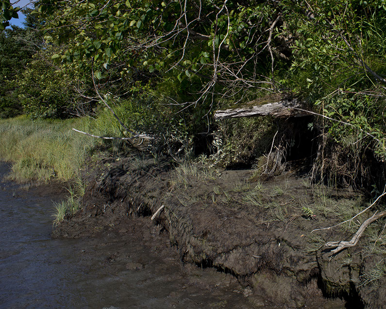
The term uplift, when speaking about the Earth, means nothing more than the ground rising up due to natural causes. When it is slow and gentle, it is called eperiogeny. But when the uplift is sudden and severe, it is known as orogeny.
There are an estimated 150,000 earthquakes around the globe each year, but only about 6,000 are powerful enough to be measured.
The 1964 earthquake in Alaska is one of the best known cases of orogeny. The earthquake, at a magnitude of 9.2, was the most powerful earthquake in North America and the second most powerful earthquake ever recorded. The most powerful earthquake, which occurred in Chile on May 22, 1960, was measured at 9.5 and caused the deaths of 1,655 people and left more than two million people homeless.
The earthquake in Alaska four years later on Good Friday, March 27, at 5:36 pm, lasted four minutes and thirty-eight seconds and killed 139 people.
The uplift caused by the mega-thrust earthquake affected 100,000 square miles out from its epicenter, about seventy-eight miles east of Anchorage and forty miles west of Valdez. In some places the ground rose up thirty-eight feet.
The earthquake caused the ground to rise an average of eight feet. Evidence of the uplift can still be seen along riverbanks. It’s a cycle that has been shown to happen every few hundred years.
The Earth’s crust is twenty miles thick on average, with only about three miles of crust under the oceans. The Earth’s mantle is over 1800 miles thick. When areas of stress within the crust suddenly release, the result is an earthquake.
The uplift from the Alaska earthquake not only devastated cites, particularly Anchorage, but adversely affected some parts of the marine based economy. Cordova once had a thriving razor clam industry, but the uplift pushed the clam beds higher than the high tide mark, ending a traditional source of food and income.
The Copper River Delta, once a saltwater area, became a fresh water ecosystem due to the 1964 earthquake uplift, creating a 700,000-acre continuous wetlands, the largest on the Pacific Coast of North America.

http://www.pmel.noaa.gov/co2/story/What+is+Ocean+Acidification%3F
https://www.sfos.uaf.edu/oarc/
Field Notes From A Catastrophe (2006) Elizabeth Kolbert
http://nsidc.org/cryosphere/seaice/processes/albedo.html
http://www.global-greenhouse-warming.com/anthropogenic-climate-change.html
http://www.bbc.co.uk/news/science-environment-13335683
http://en.wikipedia.org/wiki/Human_impact_on_the_environment
Ehrlich, P.R. (1989). “The limits of substitution – meta-resource depletion and a new economic-ecological paradigm
http://www.adfg.alaska.gov/index.cfm?adfg=brownbear.rangemap
http://www.defenders.org/grizzly-bear/basic-facts
http://www.adfg.alaska.gov/index.cfm?adfg=brownbear.main
http://nsidc.org/cryosphere/allaboutcryosphere.html
http://exploratorium.edu/climate/cryosphere/index.html
https://accap.uaf.edu/sites/default/files/Changing_Ice_September_2013_1.pdf
http://education.nationalgeographic.com/education/encyclopedia/delta/?ar_a=1
http://www.inforain.org/copperriver/content/pages/background/ecology.htm
http://www.fs.usda.gov/Internet/FSE_DOCUMENTS/stelprdb5299822.pdf
http://igloo.atmos.uiuc.edu/SNAP/
http://www.artistsfornature.com/projects/copper-river-delta/
http://www.fws.gov/willamettevalley/Complex/dusky.html
http://www.uaa.alaska.edu/elders/upload/yr2_4ltc.pdf
http://elders.uaa.alaska.edu/reports/yr1_1health-status.pdf
http://www.nativescience.org/html/traditional_knowledge.html
http://www.wipo.int/tk/en/tk/
http://www.cbd.int/traditional/intro.shtml
http://copperriver.org/buy-fish/fish-info
http://www.jobmonkey.com/alaska/html/gillnetting.html
Satellite Image Atlas of Glaciers of the World; Alaska. U.S. Geological Survey Professional Paper 1386-K; 1988.
http://nsidc.org/cryosphere/glaciers/questions/what.html
http://en.wikipedia.org/wiki/Glacier
http://faculty.clintoncc.suny.edu/faculty/michael.gregory/files/ENV%20101/ENV%20101%20Laboratory/Mark-Recapture%20Sampling/lincoln%20instructions-dried%20bean%20version.htm
http://people.hws.edu/ryan/Ryan/Pages/Petersen2.html
http://pwssc.org/research/fish/hatchery-wild-salmon-interactions/
http://mtalab.adfg.alaska.gov/OTO/marking.aspx
http://scholar.google.com/scholar_url?hl=en&q=http://hrcak.srce.hr/index.php%25253Fshow%25253Dclanak_download%252526id_clanak_jezik%25253D13710&sa=X&scisig=AAGBfm09myk4Iq7ohzJ13IQCkb_xutvU5Q&oi=scholarr
http://www.epa.gov/climatestudents/impacts/signs/permafrost.html
http://www.arctic.noaa.gov/detect/land-permafrost.shtml
http://www.merriam-webster.com/dictionary/permafrost
http://ipa.arcticportal.org/resources/what-is-permafrost#
http://www.adfg.alaska.gov/index.cfm?adfg=animals.listfish
http://www.fishbase.org/Summar/FamilySummary.php?Family=Salmonidae
http://www.merriam-webster.com/dictionary/salmonidae
http://www.burkemuseum.org/static/FishKey/salmon.html
http://www.fws.gov/alaska/fisheries/mmm/seaotters/otters.htm
http://www.huffingtonpost.com/2012/09/10/sea-otters-climate-change_n_1870588.html
http://wildlife.ucsc.edu/videos/sea-otters-v-climate-change/
http://www.bbc.com/future/story/20140121-sea-otters-our-ocean-protectors
http://www.centerforoceansolutions.org/projects/pacific-ocean-initiative/major-threats-pacific-ocean/climate-change
http://www.centerforoceansolutions.org/?q=projects/pacific-ocean-initiative/major-threats-pacific-ocean/overfishing-and-exploitation
http://www.thekitchn.com/this-is-one-way-to-catch-salmon-in-alaska-193566
http://oceanservice.noaa.gov/websites/retiredsites/sotc_pdf/IEF.PDF
http://www.greenpeace.org/international/en/news/Blogs/makingwaves/when-purse-seining-goes-bad/blog/11803/
http://dnr.alaska.gov/commis/opmp/anilca/
http://www.akhistorycourse.org/articles/article.php?artID=259
http://www.adfg.alaska.gov/index.cfm?adfg=subsistence.hunting
http://www.eyaktek.com/index.pl?id=2906;isa=Category;op=show
http://www.blm.gov
http://geology.csupomona.edu/drjessey/class/Gsc101/Earthquake.html
http://earthquake.usgs.gov/earthquakes/states/events/1964_03_28_pics.php
http://www.britannica.com/EBchecked/topic/618694/uplift


